TrendTech
Web&App Design
2021 - 2022
Senior Product Design

Project Overview
Problem
Real estate agents rely on third-party mapping services to select areas and provide information to clients. This lowers user engagement with our platform and creates limitations for them.
Task
Design a fully functional map module with features like route building, traffic updates during peak hours, and neighborhood panoramas. This will reduce the need for users to turn to external maps, which they currently prefer for tasks like route planning.
Solution
We developed a map module that shows pins for residential and commercial properties with minimum prices. It also includes route building, traffic updates, panoramas, and both paid and free parking options. After testing, we refined the interface based on feedback and successfully implemented these features in our mobile app.


Route Planning

Property Display on the Map

Map in the Mobile App
Process
Discovery
During the discovery phase, we conducted competitor analysis, user surveys, and problem interviews. This helped us identify key user interaction points with mapping services, as well as the common issues and challenges they face.
Wireframes & Testing
Using the insights we gathered, we designed wireframes and created prototypes for testing. All wireframes were based on our design system, which sped up the process and made testing more efficient.
Design
After analyzing the test results, we made adjustments, aligned them with business requirements, and incorporated additional user feedback. We then proceeded with the design phase, creating designs for both the web platform and mobile application.

Design Process
Surveys
We conducted a survey to pinpoint the main touchpoints between users and mapping services. The survey also provided insights into the key user requirements for map interface elements.
Глубинные интервью
Through interviews, we learned that users often use third-party mapping tools in client meetings to display areas and neighborhoods. They also use these tools to plan routes and present them to clients, helping them understand commute times, traffic conditions, and more. From these findings, we developed a set of user stories to guide the design and functionality decisions.

Survey Results

Key Findings from Interviews and Surveys

User Stories
Ideate
User Flows
With user requirements and stories in mind, we started designing user flows for the core functionality of the map module.
Wireframes & Prototyping
Leveraging our design system, we efficiently built wireframes and prepared prototypes for user testing.
Testing
We conducted tests on the prototypes and proof of concept (PoC) with users to evaluate how intuitive and user-friendly the interface was.

Route Planning and Vehicle Type Flow Diagram

Traffic Statistics View

Routes
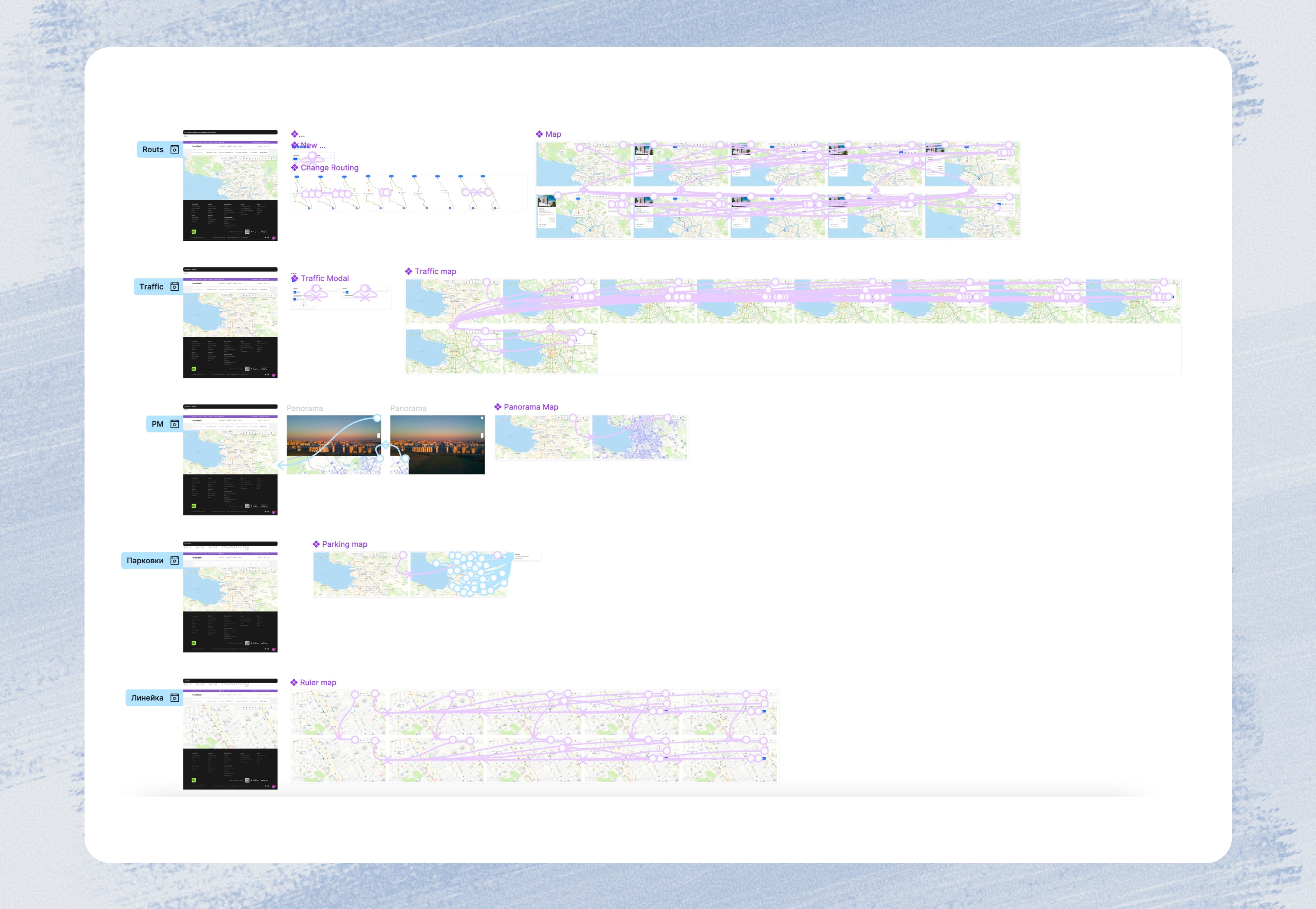
Prototypes for Testing
Testing
Usability Testing
We carried out usability testing to observe how users navigate the interface, assess their learning curve, and uncover critical usability problems.
Conclusions
Through this process, we pinpointed major interface issues, collected valuable user feedback, and derived insights that guided us in refining the interface.

Goals
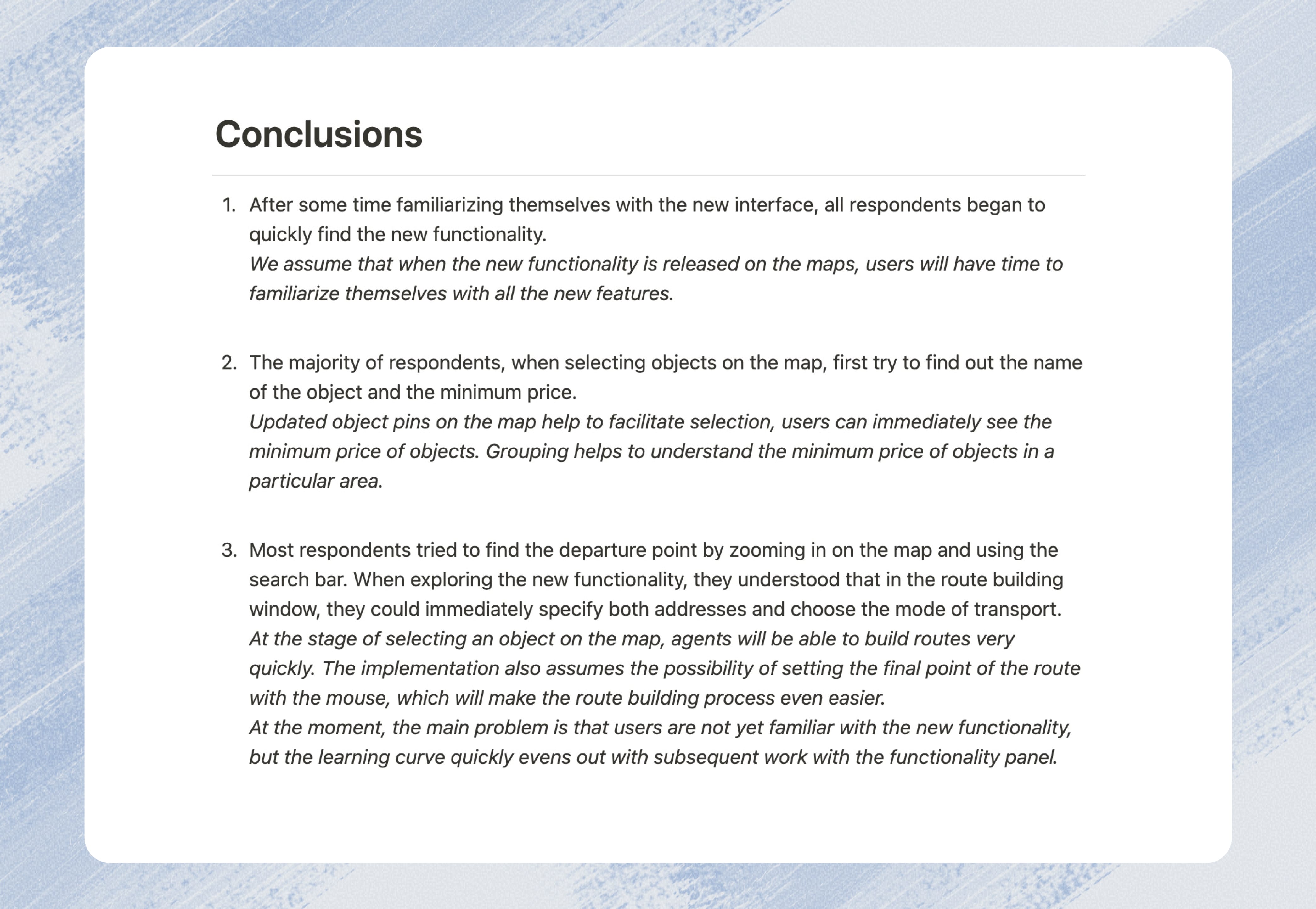
Conclusions
Map
Residential Property Display on the Map
An agent can start planning a route from any selected property to any destination on the map.
Full Property Listings on the Map
Agents can also use input fields to enter specific addresses, enabling precise route planning to and from selected locations.

Residential Properties on the Map
All Property Types on the Map
Routs
Marker Selection on the Map
Agents can initiate route planning from any selected property to any location on the map.
Entering Addresses
Agents can also input addresses in the designated fields, allowing them to specify exact locations for route planning.
Routs
Traffic Statistics
Traffic Statistics by Time of Day
Agents can choose specific time periods to show traffic statistics, allowing clients to determine the best times for driving or using public transport.

Traffic Statistics
Building Structures
Displaying Information on Building Structures
For real estate properties, it’s important to show the completion timelines of the buildings. When zooming in on the map, pins for each building appear, indicating their expected handover dates.

Buildings and Handover Dates